 Add Row
  Add
Add 


A Breakthrough in Ocean Mapping: A New Era of Autonomous Surveys
The ocean is vast, and understanding its depths has historically required significant manpower and traditional vessels. However, that narrative is changing. Saildrone’s recent collaboration with Meta marks a watershed moment in marine technology, as they successfully completed the first unmanned and autonomous deep-water route survey in the North Atlantic.
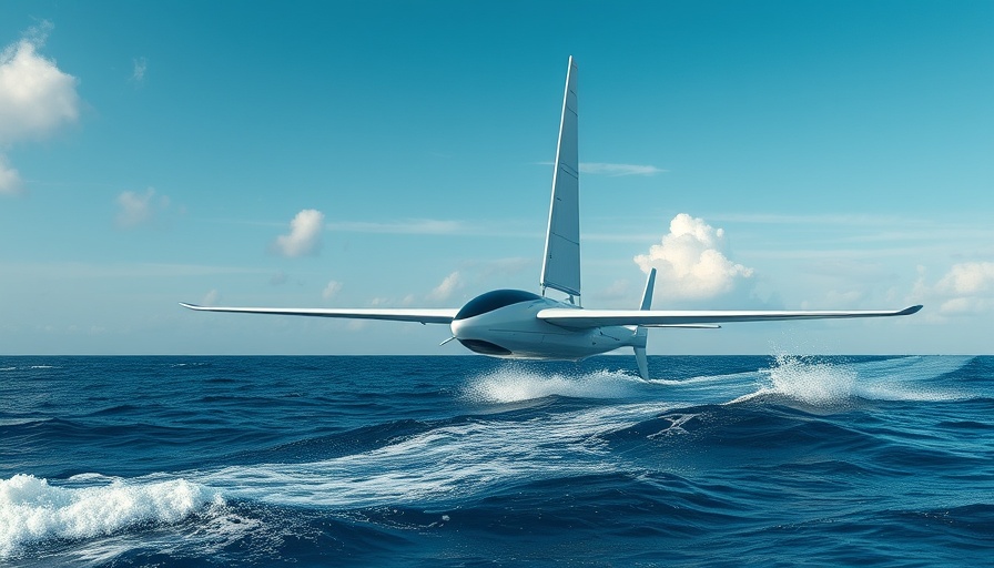
Utilizing the Saildrone Surveyor—a 20-meter uncrewed surface vehicle (USV)—the project spanned 26 days in mid-2024, covering over 4,500 kilometers of seabed with remarkable precision. Equipped with cutting-edge technology including a Kongsberg EM304 MKII multibeam sonar, the Surveyor achieved incredible swath coverage, demonstrating its efficiency under challenging conditions without any human crew on board.
Autonomous Technology Meets Human Need
This mission showed more than just technical capability; it also highlighted a concern about the well-being of those who typically man these surveys. Traditionally, human surveyors endure extended periods away from home, leading to strains on mental health and family life. With the ability to operate from shore-based offices, this new system reduces these pressures significantly. Andy Palmer-Felgate from Meta emphasized this transformation, noting how it not only enhances operational efficiency but also improves quality of life for professionals in the field.
Environmental Impact: Sailing Towards Sustainability
Perhaps one of the most striking aspects of the Saildrone mission is its commitment to sustainability. In comparison to conventional vessels, the Saildrone Surveyor avoided an estimated 243 tons of CO₂ emissions—over 50 times less. This impressive reduction underscores how adopting uncrewed systems could lead to greener practices within the maritime industry, which is crucial as environmental concerns continue to take center stage worldwide.
The Future of Ocean Exploration: Implications for Subsea Cable Surveys
This pioneering project sets a precedent for future ocean explorations and subsea cable route surveys. The implications are profound, as traditional methodologies can be both expensive and time-consuming. As the demand for subsea infrastructure grows, so too does the necessity for enhanced mapping techniques. The real-time monitoring and adaptability demonstrated during the Saildrone mission open doors for agile responses to unpredicted seabed features, optimizing routing while ensuring safety and quality.
Conclusion: A New Horizon in Marine Technology
As technology continues to advance, the fusion of autonomous vehicles and marine surveying could redefine how we approach and understand our oceans. Saildrone and Meta’s successful deep-water route survey is not simply a technological triumph; it is a testament to how human ingenuity can yield solutions that are safer, more efficient, and environmentally responsible. The future of ocean exploration is bright, and it’s floating right into view.


 Add Row
  Add
Add 
Write A Comment